
Dwaraka Fm
Type Locality and Naming
OUTCROP: Western coastal track of Saurashtra. Reference well: Well OS-2-G-1, interval 0 to 875 m
Synonyms: Dwarka (spelling version by Directorate of Hydrocarbons); Dwaraka beds
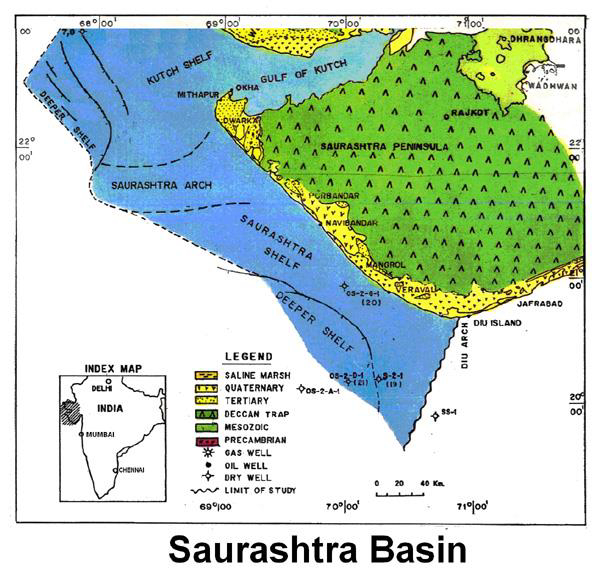
[Figure 1: Index Map of Saurashtra Basin (from dghindia.gov.in)]
Lithology and Thickness
Shallow-marine marl. It consists of silty clay, argillaceous and fossiliferous limestone. In offshore Saurashtra it contains limestone and shale alternations in the well OS-2-G-1. In the coastal part it is 40 m thick. It increases to 865 m in offshore well OS-2-G-1.
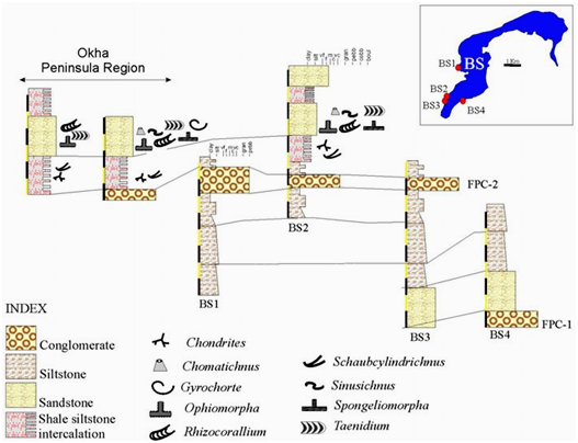
[Figure 2: Stratigraphic sections exposed in the various locations at Bet Shankhodhar and Okha Peninsula areas. The trace fossils described in this study belong to upper part of the member (modified after Sakhawala, 1990) (FPC = flat pebble conglomerate; BS = Bet Shankhodhar)]
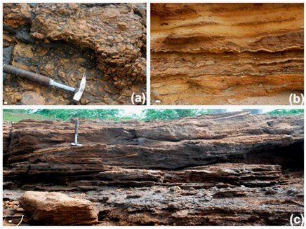
[Figure 3: Lithofacies and sedimentary structures of the Shankhodhar Sand Clay Member, white bar in the left lower corner equals to 1 cm (after Desai, B.S., 2015)] (a) flat pebble conglomerate lithofacies, the clasts are of same lithology (Hammer length 30 cm); (b) shale–siltstone intercalations, the siltstones are thin to very thin and belong to lower part of the facies; (c) Hummocky cross-stratification in sandstones showing convex laminations bounded by truncations.
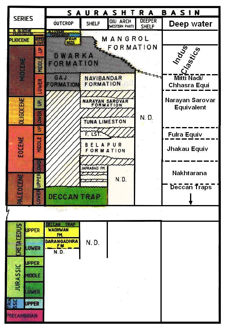
[Figure 3: Generalized Stratigraphy of Saurashtra Basin (from dghindia.gov.in)]
Relationships and Distribution
Lower contact
Lower boundary is conformable with the Gaj Fm (outcrop), Nabibandar Fm (subsurface)
Upper contact
Upper boundary is unconformable with the Porbandar Fm, or locally overlain by an intermediate Piram Bed Fm.
Regional extent
GeoJSON
Fossils
Biofacies
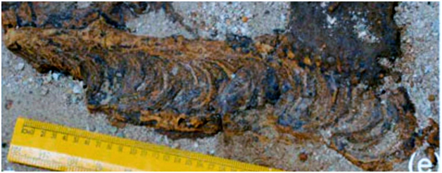
(e) Rhizocorallium commune var. irregular showing well-developed spreiten structure and prominent marginal tube
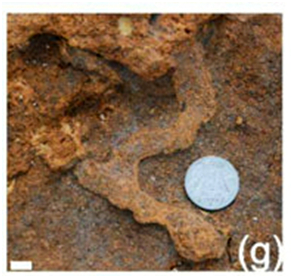
(g) Sinusichnus isp. showing irregular sinuous tunnels.
[Figure 4: (e) Rhizocorallium commune var. irregular showing well-developed spreiten structure and prominent marginal tube (after Desai, B.S., 2015)]
[Figure 5: (g) Trace fossils from upper part of the Shankhodhar Sand Clay Member, white bar in left lower corner equals to 1 cm (after Desai, B.S., 2015)]
[Figure 6: (b) Irregular network of O. nodosa burrow network form (after Desai, B.S., 2015)]

Age
Depositional setting
Inner shelf, transgressive.
Additional Information